
In July 2022, the FRM4Veg team returned to Las Tiesas Experimental Farm in Spain, but this time together with other teams, all gathered there to pursue one major goal: flying their UAV-mounted cameras to contribute towards the development of a community agreed good practice protocol for collecting UAV-based surface reflectance data for satellite product validation.
As such, SRIX4Veg brought in the international community to determine the expected deviations in surface reflectance reference data collected from UAVs operated by different groups under the same conditions and over the same area.
The activity was funded by ESA, endorsed by the Committee on Earth Observation Satellites (CEOS) and it represented a collaboration between ESA, USGS (United States Geological Survey), CSIRO (Commonwealth Scientific and Industrial Research Organisation), Geoscience Australia, DLR (German space agency) and ASI (Italian Space Agency).
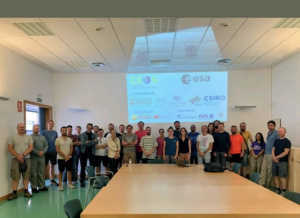
Seven teams took part to the exercise (Figure 1): NRC (National Research Council Canada), RIT (Rochester Institute of Technology), NERC (Natural Environment Research Council), NPL (National Physical Laboratory), WUR (Wageningen University and Research), GFZ (German Research Centre for Geosciences) and GEO-K s.r.l.
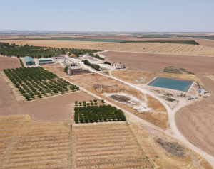
SRIX4Veg took place in the week of the 18th of July 2022 (18th – 22nd July) at Las Tiesas experimental farm near Barrax, Spain (Figure 2). This site was established in 1999 and it meets the main FRM requirements for satellite validation purposes (e.g., flat, large and uniform land-use units representative of different crop types, good accessibility by road, good connection with site owners and research groups, 90% likelihood of clear skies in July, etc.).
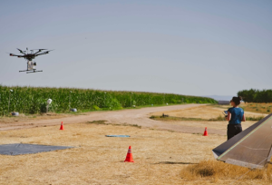
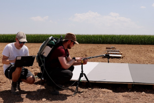
All the teams’ instruments and payloads were restricted to certain specifications: instruments were required to have contiguous spectral bands within the 400 nm- 1000 nm spectral range, a spectral resolution no greater than 10 nm and a maximum UAV and payload weight no greater than 25 kg to adhere to UAV legislation. The NPL team were responsible for the organization of the activity, but they also have scientifically contributed to the intercomparison exercise by using their UAV-mounted coaligned VNIR/SWIR camera to record surface reflectance data (Figure 3).
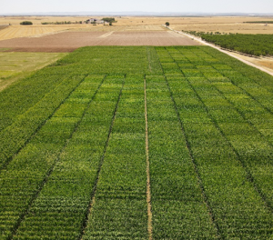
The exercise was conducted via two experiments: 1) where a standardised protocol was developed by the NPL team and adhered to and 2) where each team collected data according to their approach. Experiment 1 was planned based on a typical Sentinel-2 (S2) satellite overpass; the UAV flights were performed over a corn field (Figure 4) covering an area of 60 m x 60 m (consistent with 3 x 3 pixels at 20 m resolution of S2) to measure the Hemispherical-Directional Reflectance Factor (HDRF). The take-off and landing locations were the same for all the teams, and each participant flew back-to-back in a round robin experiment. 52 flights were done throughout the week.
The UAV-imager acquisitions were supported by on- ground measurements: a base station was used to collect GNSS data; an ASD Fieldspec 4 spectrometer was used to transfer the reflectance calibration of a Spectralon panel to the reference tarpaulins viewed by the imagers during the flights; and Aerosol Optical Thickness (AOT) measurements were collected using a Microtops Sunphotometer.
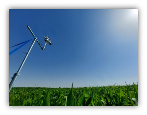
During SRIX4Veg, a HYPERNETS system (Figure 6) was also installed on a temporary mast to test the instrument and to provide field data to support the exercise. The instrument took surface reflectance measurements over the corn field every half hour between 8 am and 6 pm each day.
The teams are now focussing on analysing the data gathered during the exercise and a workshop with all the participants is planned to happen in the next few months to discuss the results of the activity, provide feedback, share and expand knowledge within the international community and to develop a community-agreed good practice protocol.
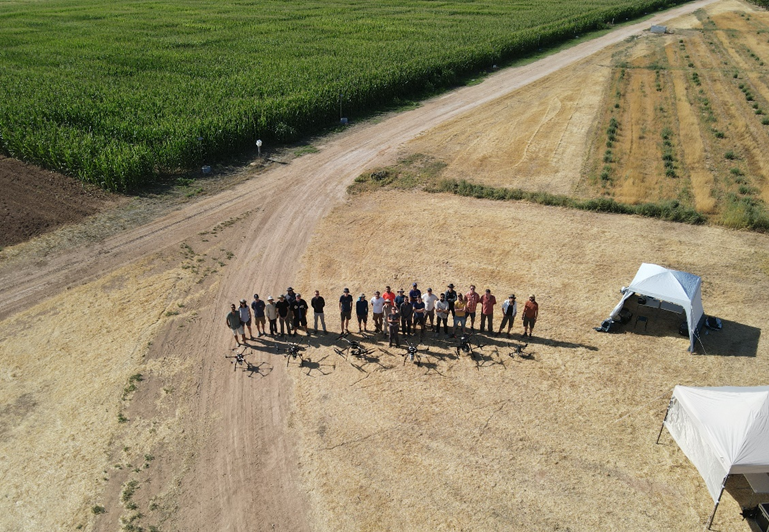
Figure 7: SRIX4Veg participants in the field