SRIX4Veg: Surface Reflectance Inter-Comparison eXercise for Vegetation

In July 2022, the FRM4Veg team returned to Las Tiesas Experimental Farm in Spain, but this time together with other teams, all gathered there to pursue one major goal: flying their UAV-mounted cameras to contribute towards the development of a community agreed good practice protocol for collecting UAV-based surface reflectance data for satellite product validation.

As such, SRIX4Veg brought in the international community to determine the expected deviations in surface reflectance reference data collected from UAVs operated by different groups under the same conditions and over the same area.

Figure 1: SRIX4Veg Kick-off meeting 18/07/2022 at the University of Castilla La Mancha, Albacete, Spain

The activity was funded by ESA, endorsed by the Committee on Earth Observation Satellites (CEOS) and it represented a collaboration between ESA, USGS (United States Geological Survey), CSIRO (Commonwealth Scientific and Industrial Research Organisation), Geoscience Australia, DLR (German space agency) and ASI (Italian Space Agency).

Seven teams took part to the exercise (Figure 1): NRC (National Research Council Canada), RIT (Rochester Institute of Technology), NERC (Natural Environment Research Council), NPL (National Physical Laboratory), WUR (Wageningen University and Research), GFZ (German Research Centre for Geosciences) and GEO-K s.r.l.

Figure 2: Las Tiesas Experimental Farm, Barrax, Spain

SRIX4Veg took place in the week of the 18th of July 2022 (18th – 22nd July) at Las Tiesas experimental farm near Barrax, Spain (Figure 2). This site was established in 1999 and it meets the main FRM requirements for satellite validation purposes (e.g., flat, large and uniform land-use units representative of different crop types, good accessibility by road, good connection with site owners and research groups, 90% likelihood of clear skies in July, etc.).

Figure 3: Rosalinda Morrone flying the UAV-mounted hyperspectral camera. Image courtesy of Johannes Wilk (GFZ)

All the teams’ instruments and payloads were restricted to certain specifications: instruments were required to have contiguous spectral bands within the 400 nm- 1000 nm spectral range, a spectral resolution no greater than 10 nm and a maximum UAV and payload weight no greater than 25 kg to adhere to UAV legislation. The NPL team were responsible for the organization of the activity, but they also have scientifically contributed to the intercomparison exercise by using their UAV-mounted coaligned VNIR/SWIR camera to record surface reflectance data (Figure 3).

Figure 4: Corn field where the UAV flights were performed during SRIX4Veg

The exercise was conducted via two experiments: 1) where a standardised protocol was developed by the NPL team and adhered to and 2) where each team collected data according to their approach. Experiment 1 was planned based on a typical Sentinel-2 (S2) satellite overpass; the UAV flights were performed over a corn field (Figure 4) covering an area of 60 m x 60 m (consistent with 3 x 3 pixels at 20 m resolution of S2) to measure the Hemispherical-Directional Reflectance Factor (HDRF).  The take-off and landing locations were the same for all the teams, and each participant flew back-to-back in a round robin experiment. 52 flights were done throughout the week.

Figure 5: Luke Brown and Harry Morris taking measurements of the tarpaulin with the ASD

The UAV-imager acquisitions were supported by on- ground measurements: a base station was used to collect GNSS data; an ASD Fieldspec 4 spectrometer was used to transfer the reflectance calibration of a Spectralon panel to the reference tarpaulins viewed by the imagers during the flights; and Aerosol Optical Thickness (AOT) measurements were collected using a Microtops Sunphotometer.

Figure 6: HYPERNETS instrument mounted over the corn field

During  SRIX4Veg, a HYPERNETS system (Figure 6) was also installed on a temporary mast to test the instrument and to provide field data to support the exercise. The instrument took surface reflectance measurements over the corn field every half hour between 8 am and 6 pm each day.

The teams are now focussing on analysing the data gathered during the exercise and a workshop with all the participants is planned to happen in the next few months to discuss the results of the activity, provide feedback, share and expand knowledge within the international community and to develop a community-agreed good practice protocol.

Figure 7: SRIX4Veg participants in the field

Returning to Wytham Woods and Las Tiesas experimental farm in 2021

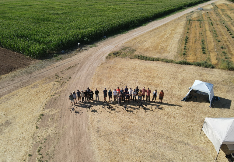
Wytham Woods (part one)

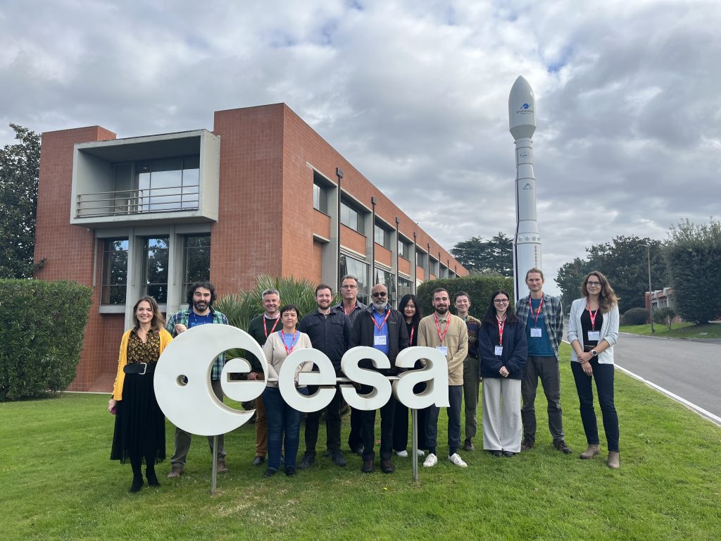
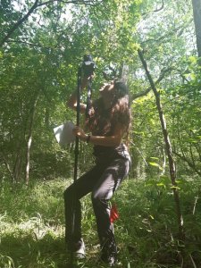
The FRM4VEG team gather at Wytham Woods.

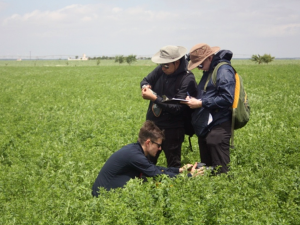
In what was forecast to be a rather hot week, scientists from the University of Southampton returned to Wytham Woods on the 19th July for the third campaign of the FRM4VEG programme, joined on the following day by a team from the National Physical Laboratory (NPL).

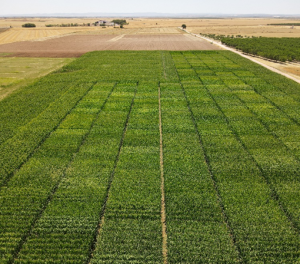
The focus of the campaign was the measurement of canopy chlorophyll content (CCC) and the fraction of absorbed photosynthetically active radiation (FAPAR). Following the protocols and procedures developed during Phase 1 of the FRM4VEG programme (and further refined in Phase 2), measurements were conducted within elementary sampling units (ESUs) of 20 m x 20 m, enabling them to be directly related to data from Sentinel-2’s Multispectral Instrument (MSI) for the purposes of upscaling. By the end of the campaign 24 ESUs has been characterised, covering forest, grassland and bare soil areas.

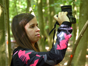
Rosalinda Morrone of the National Physical Laboratory acquires digital hemispherical photography.

The morning of the first day of the campaign was spent getting to grips with the data collection protocols, including setting up the sampling grid within the ESU and ensuring the correct camera settings for digital hemispherical photography (DHP). Following lunch, the team then got on with the hard work of data collection, completing five forest ESUs on the first day.

Wednesday saw another day of hot weather, but despite the heat, the team managed to sample one forest and four grassland ESUs in the morning, and another three forest and two grassland ESUs in the afternoon.

Thursday brought with it a little disappointment, as technical issues meant the DHP team had to repeat a number of ESUs from the previous days. Now well-versed in the measurement protocol, they managed to work through these quickly, and were soon able to rejoin the rest of the team to complete the final six forest ESUs.

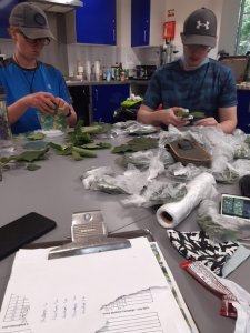
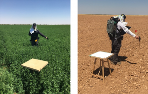
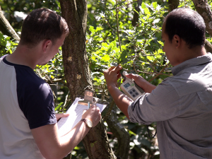
Merryn Hunt and Owen Williams of the University of Southampton measure sampled leaves with a chlorophyll meter, before bagging them for subsequent laboratory analysis.

Friday morning saw the final push to collect the remaining data before the team needed to depart. Half of the team headed off to meet a local farmer to access three bare soil ESUs. In fact, these turned out not to be as bare as satellite images suggested, with fields actually containing grass planted in rows with gaps between. Nonetheless, DHP images were acquired, and, in light of the fact that there was vegetation present, grass samples collected so that leaf chlorophyll concentration (LCC) could be measured back at the chalet.

Meanwhile, the remainder of the team collected and bagged leaf samples for laboratory analysis and chlorophyll meter calibration back in Southampton, also conducting measurements at several stages of Wytham’s monitoring tower to assess vertical variations in LCC. With that done, the team departed Wytham Woods with a successful campaign under their belts.

Las Tiesas experimental farm

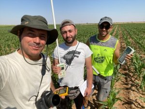
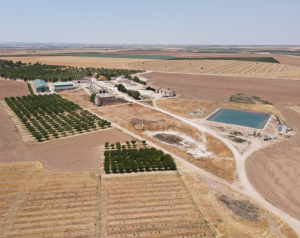
The team from EOLAB prepare to sample an ESU at Las Tiesas experimental farm.

The same week, on the 19th July, the team from EOLAB returned to Las Tiesas experimental farm for the FRM4VEG programme’s fourth campaign. As at Wytham, the focus was on CCC and FAPAR measurements, which were conducted according to the protocols and procedures developed in Phase 1 of the FRM4VEG programme (and refined during Phase 2).

Unlike the campaign in 2018, which saw an uncharacteristic rainstorm descend on the region, the weather conditions were perfect for field work, enabling an efficient and successful data collection.

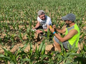
Measuring leaf chlorophyll concentration.

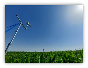
Thanks to the lower height of the crop canopy, the team were able to collect additional measurements using the LI-COR LAI-2200 and AccuPAR LP-80 instruments in addition to DHP (the former instruments require above-canopy reference readings, which prove challenging in a forest unless two sensors are available). These additional data will prove useful to assess the consistency and biases associated with different measurement techniques. As at Wytham, a chlorophyll meter was used to assess leaf chlorophyll concentration.

A pepper field sampled during the campaign.

A wide range of crops were sampled throughout the campaign, including alfalfa, corn, lettuce, onion, and pepper fields, in addition to several harvested and bare soil fields. In total, FAPAR was characterised over 79 ESUs (27 of which represented harvested or bare soil fields). Due to the chlorophyll meter being ill-suited to measuring onion leaves, CCC was determined at 69 ESUs.

The cloud-free conditions experienced throughout the week will ensure the data collected during the campaign can be fully exploited for upscaling using Sentinel-2 and subsequent validation of the Sentinel-3 products.

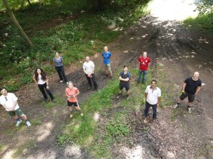
Wytham Woods (part two)

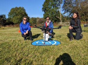
The NPL team feeling good after the data collection.

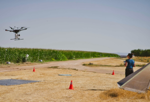
On the 21st October 2021, scientists from the National Physical Laboratory and the University of Southampton returned once again to Wytham Woods to acquire surface reflectance data for the validation of the Sentinel-2 L2A product.

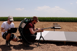
The team assembled at 09:00 UTC to begin preparing for the overpass of Sentinel-2A at around 11:27 UTC. Setup of various instruments was required in order to validate the expected overpasses, including an ASD field spectrometer, Microtops sunphotometer, GPS base station, and the UAV-mounted hyperspectral imager. Additionally, a reference tarpaulin and Spectralon panel were set up to provide a calibrated reference reflectance for the hyperspectral imager.

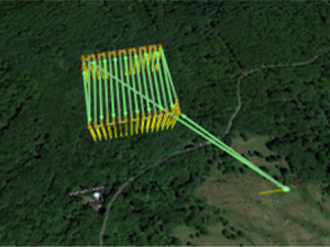
The flight plan used for collecting the UAV-mounted hyperspectral imager data.

As the satellite overpass approached, the instruments were turned on so that they could warm up sufficiently and stabilise their response. The flight plan of the UAV and a polygon telling the instrument when to start measuring were uploaded and checked. Finally, seven minutes before the expected overpass, the UAV was launched and flown to the start of the flight plan where the software takes over. After this, the UAV flew according to flight plan, while the instrument captured data within the defined polygon.

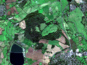
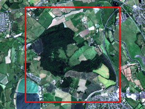
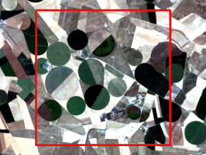
The cloud-free Sentinel-2A data over Wytham Woods on the 21/10/2021. Contains Copernicus Sentinel data 2021.

The measurement area was 180 m x 180 m, in accordance with a 3 x 3 pixel estimate of Sentinel-2’s coarsest resolution bands (60 m), and was completely forested. Fortunately, the time of the overpass was completely cloud-free, making it perfect for surface reflectance data acquisition conditions for both the UAV-mounted imager and the satellite.

The return to Barrax – Las Tiesas

In the midst of heatwave conditions, even for La Mancha in August, a small team from the National Physical Laboratory (NPL) returned to Barrax to conduct a second set of reflectance measurements. Our aim was straightforward: collect surface reflectance (specifically hemispherical-conical reflectance factor – HCRF) data to internationally recognised fiducial reference measurement (FRM) standards, coincide with the satellite overpasses of Sentinel-2A, the twin Sentinel-3 pair orbiting in tandem, PROBA-V and Landsat 8 – all within a measurement window of 90 minutes. So the date was set for Thursday the 2nd August 2018.

On Wednesday morning, the day before the overpass, we found ourselves in the familiar surroundings of the Barrax – Las Tiasas experimental farm, greeted by clear blue skies. We set to work assessing the current crop conditions and formulating plans for the next day. The plan was to take two sets of measurements within the overpass window – one over the low reflectance alfalfa field (from the pea family) and one from high reflectance bare soil.

At the height of summer, most fields in the vicinity were not cultivated, except where the rotating hydration system was activated (hence the circular fields). The image below is the Sentinel 2 image on the day. Although it would appear at a glance that most of the area was in a ‘bare soil’ phase, in reality the closest fields to the green alfalfa area contained crop or other debris from previous farming cycles, so discounted as test sites. After some walking around two sites were selected, all we had to do was wait for the satellites!

The location of our two measurement areas marked out in red (click to expand).

Plots, of dimension 200 m by 200 m, were paced out using GPS, and measurement locations within these plots marked with flags. Every preparation was made to save time in the critical period of the following day – a schedule was scrupulously prepared to account for every precious minute of the multi-overpass window.

As Thursday dawned, the team set out provisioned with copious water supplies. At each point, the spectroradiometer was normalised to the reference Spectralon panel (tuning the sensor configuration: integration time, etc.) with two panel reflectance measurements made either side of four reflectances measurements. With bare soil readings completed, we rapidly shifted operations to the alfalfa field and took a further set of measurements there, carrying the heavy calibration panel and other equipment through the dense field all the while watching out for the (well-concealed) irrigation channels that criss-crossed the field. At the time of the overpass it was easy to imagine the satellites zooming over ahead, though of course invisible to us in the bright skies. A couple of hours spent shunting all measurement and calibration equipment around the fields in 40 degree temperatures was sufficient to complete our practical work, in time for a late lunch of refreshing gazpacho soup at the local roadhouse cafe.

Measurements were taken at the alfafa and bare soil sites by Niall Origo, using the portable Analytical Spectral Devices (ASD) FieldSpec 4 instrument. The Spectralon panel is shown in the foreground (left with cover on; right off).

We are now in the process of analysing the results, and, furthermore, applying FRM techniques to these data.

Thank you to Dr JosĂ© González Piqueras and Alonso Garrido, of the Universidad de Castilla La Mancha (UCLM), for generously assisting with logistics and storage of equipment. Their department does a great deal of work on both Earth Observation and long-term in-situ monitoring at this field site – check out their website (in Spanish – click small flag for the English version). We’d also like to thank ‘super-sub’ Dr Paul Green, of NPL, for stepping up to the plate to very ably assist with transport and field assistant duties.

Second validation campaign conducted by FRM4VEG scientists at Wytham Woods

Beatriz Fuster Ochando of EOLAB measures the fraction of absorbed photosynthetically active radiation.

Following the Las Tiesas campaign earlier this summer, scientists from the National Physical Laboratory (NPL), University of Southampton and EOLAB travelled to Wytham Woods on 3rd July for the second campaign of the FRM4VEG project.  The team was also joined by Dr. Mukunda Dev Behera, an Associate Professor visiting from the Indian Institute of Technology (IIT).

Located near Oxford, England, Wytham Woods is a prime example of semi-natural woodland, and has been extensively monitored over the past 75 years.  The site consists of a variety of hardwood and softwood species, including ash, beech, hazel, oak and sycamore.

Harry Morris and Julio Pastor-Guzman of the University of Southampton measure canopy chlorophyll content.

On the first day of the campaign, airborne hyperspectral data were acquired by the Natural Environment Research Council (NERC) Airborne Research Facility (ARF).  During the flight, a range of measurements were carried out on the ground to enable the effects of the atmosphere to be accounted for.  The highly detailed data provided by the instruments on-board the aircraft will be used to evaluate a range of upscaling approaches.

Throughout the rest of the week, the team focussed their efforts on measurements of the fraction of absorbed photosynthetically active radiation and canopy chlorophyll content – key parameters for describing the health of vegetation.  The sampling strategy, which was based on that adopted at Las Tiesas, was modified to enable measurements of both the forest understory and overstory.

Sentinel-2B MSI true colour composite acquired on 29th June (site shown in red). Contains modified Copernicus Sentinel data 2018.

Over the course of the campaign, a total of 42 elementary sampling units were characterised, although the logistical issues associated with sampling leaves in forest environments meant that measurements of canopy chlorophyll content were restricted to 25 of these.  Cloud-free conditions were experienced during overpasses of Sentinel-2 and -3, meaning the data collected during the campaign can be fully exploited for product validation.

A further campaign is set to take place later in the summer, in which measurements of surface reflectance will be conducted.  These measurements will make use of an unmanned aerial vehicle (UAV) to access the top of the canopy.

FRM4VEG scientists travel to Barrax – Las Tiesas experimental farm for validation campaign

Luke Brown, Julio Pastor-Guzman, and Harry Morris of the University of Southampton measure canopy chlorophyll content in an alfalfa field.

Scientists from the National Physical Laboratory (NPL), University of Southampton, EOLAB, and the European Space Agency (ESA) travelled to the Barrax – Las Tiesas experimental farm on 1st June, in preparation for a week-long campaign.  The campaign, the first of the FRM4VEG project, aimed to provide data to support validation of Copernicus products from Sentinel-2, -3 and PROBA-V.

Located near Barrax in Castilla-La-Mancha, Spain, the site has been the previous focus of multiple ESA-funded campaigns, and was selected due to its typically clear skies, flat terrain, and well-managed crops.

After a successful campaign kick-off meeting hosted by the University of Castilla-La-Mancha (UCLM) in Albacete, the teams set out to begin data collection on the morning of 2nd June, led by Dr. Fernando Camacho de Coca of EOLAB, who has extensive experience working at the site.

Harry Morris (University of Southampton), Niall Origo (NPL), Dr. José González Piqueras (UCLM), Dr. Fernando Camacho de Coca (EOLAB), Lorena de la Madrid Descalzo (EOLAB), Dr. Valentina Boccia (ESA), Luke Brown (University of Southampton), and Dr. James Ryder (NPL).

Throughout the week, the teams from EOLAB and the University of Southampton carried out measurements of biophysical variables, focusing on two key parameters that describe the health of vegetation: the fraction of absorbed photosynthetically active radiation, and canopy chlorophyll content.  Meanwhile, the team from NPL concentrated their efforts on measurements of surface reflectance, the fundamental quantity upon which satellite-derived biophysical variables are based.

Measurements of the biophysical variables were conducted in elementary sampling units of 20 m by 20 m, enabling them to be directly related to data from Sentinel-2’s Multispectral Instrument (MSI).  By the end of the campaign, 52 elementary sampling units had been characterised, covering 7 different crop types (alfalfa, garlic, rapeseed, spring onion, sunflower, poppy and wheat), in addition to a number of bare soil areas.

Sentinel-2A MSI true colour composite acquired on 13th June (site shown in red).  Contains modified Copernicus Sentinel data 2018.

Despite persistent cloud cover throughout the campaign, conditions improved the following week, during which cloud-free Sentinel-2 and -3 overpasses were made.  Given the stability in vegetation conditions at the site, the data acquired during these overpasses will prove useful, both for upscaling and product validation.  Nevertheless, the cloud cover hampered the collection of surface reflectance measurements, which require stable illumination and coincidence with the satellite overpass.  As a result, a follow-up campaign is set to take place in July.


Campaign readiness review

In preparation for the validation campaigns at Barrax – Las Tiesas in June and Wytham Woods in July, the campaign readiness review was successfully completed on 23rd May 2018.  In addition to  logistical details, the readiness of all campaign instrumentation was confirmed.