Wytham Woods (part one)
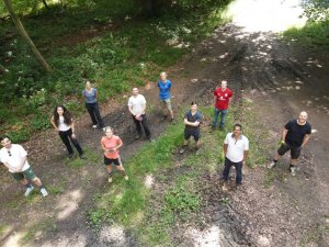
The FRM4VEG team gather at Wytham Woods.
In what was forecast to be a rather hot week, scientists from the University of Southampton returned to Wytham Woods on the 19th July for the third campaign of the FRM4VEG programme, joined on the following day by a team from the National Physical Laboratory (NPL).
The focus of the campaign was the measurement of canopy chlorophyll content (CCC) and the fraction of absorbed photosynthetically active radiation (FAPAR). Following the protocols and procedures developed during Phase 1 of the FRM4VEG programme (and further refined in Phase 2), measurements were conducted within elementary sampling units (ESUs) of 20 m x 20 m, enabling them to be directly related to data from Sentinel-2’s Multispectral Instrument (MSI) for the purposes of upscaling. By the end of the campaign 24 ESUs has been characterised, covering forest, grassland and bare soil areas.
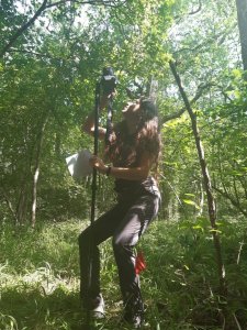
Rosalinda Morrone of the National Physical Laboratory acquires digital hemispherical photography.
The morning of the first day of the campaign was spent getting to grips with the data collection protocols, including setting up the sampling grid within the ESU and ensuring the correct camera settings for digital hemispherical photography (DHP). Following lunch, the team then got on with the hard work of data collection, completing five forest ESUs on the first day.
Wednesday saw another day of hot weather, but despite the heat, the team managed to sample one forest and four grassland ESUs in the morning, and another three forest and two grassland ESUs in the afternoon.
Thursday brought with it a little disappointment, as technical issues meant the DHP team had to repeat a number of ESUs from the previous days. Now well-versed in the measurement protocol, they managed to work through these quickly, and were soon able to rejoin the rest of the team to complete the final six forest ESUs.
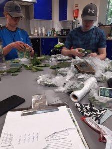
Merryn Hunt and Owen Williams of the University of Southampton measure sampled leaves with a chlorophyll meter, before bagging them for subsequent laboratory analysis.
Friday morning saw the final push to collect the remaining data before the team needed to depart. Half of the team headed off to meet a local farmer to access three bare soil ESUs. In fact, these turned out not to be as bare as satellite images suggested, with fields actually containing grass planted in rows with gaps between. Nonetheless, DHP images were acquired, and, in light of the fact that there was vegetation present, grass samples collected so that leaf chlorophyll concentration (LCC) could be measured back at the chalet.
Meanwhile, the remainder of the team collected and bagged leaf samples for laboratory analysis and chlorophyll meter calibration back in Southampton, also conducting measurements at several stages of Wytham’s monitoring tower to assess vertical variations in LCC. With that done, the team departed Wytham Woods with a successful campaign under their belts.
Las Tiesas experimental farm
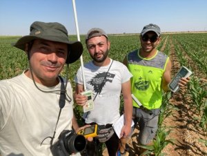
The team from EOLAB prepare to sample an ESU at Las Tiesas experimental farm.
The same week, on the 19th July, the team from EOLAB returned to Las Tiesas experimental farm for the FRM4VEG programme’s fourth campaign. As at Wytham, the focus was on CCC and FAPAR measurements, which were conducted according to the protocols and procedures developed in Phase 1 of the FRM4VEG programme (and refined during Phase 2).
Unlike the campaign in 2018, which saw an uncharacteristic rainstorm descend on the region, the weather conditions were perfect for field work, enabling an efficient and successful data collection.
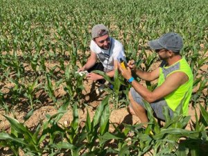
Measuring leaf chlorophyll concentration.
Thanks to the lower height of the crop canopy, the team were able to collect additional measurements using the LI-COR LAI-2200 and AccuPAR LP-80 instruments in addition to DHP (the former instruments require above-canopy reference readings, which prove challenging in a forest unless two sensors are available). These additional data will prove useful to assess the consistency and biases associated with different measurement techniques. As at Wytham, a chlorophyll meter was used to assess leaf chlorophyll concentration.
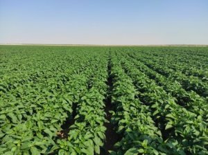
A pepper field sampled during the campaign.
A wide range of crops were sampled throughout the campaign, including alfalfa, corn, lettuce, onion, and pepper fields, in addition to several harvested and bare soil fields. In total, FAPAR was characterised over 79 ESUs (27 of which represented harvested or bare soil fields). Due to the chlorophyll meter being ill-suited to measuring onion leaves, CCC was determined at 69 ESUs.
The cloud-free conditions experienced throughout the week will ensure the data collected during the campaign can be fully exploited for upscaling using Sentinel-2 and subsequent validation of the Sentinel-3 products.
Wytham Woods (part two)
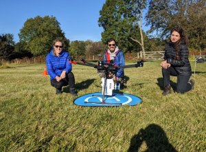
The NPL team feeling good after the data collection.
On the 21st October 2021, scientists from the National Physical Laboratory and the University of Southampton returned once again to Wytham Woods to acquire surface reflectance data for the validation of the Sentinel-2 L2A product.
The team assembled at 09:00 UTC to begin preparing for the overpass of Sentinel-2A at around 11:27 UTC. Setup of various instruments was required in order to validate the expected overpasses, including an ASD field spectrometer, Microtops sunphotometer, GPS base station, and the UAV-mounted hyperspectral imager. Additionally, a reference tarpaulin and Spectralon panel were set up to provide a calibrated reference reflectance for the hyperspectral imager.
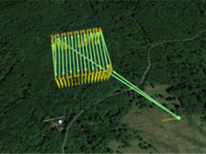
The flight plan used for collecting the UAV-mounted hyperspectral imager data.
As the satellite overpass approached, the instruments were turned on so that they could warm up sufficiently and stabilise their response. The flight plan of the UAV and a polygon telling the instrument when to start measuring were uploaded and checked. Finally, seven minutes before the expected overpass, the UAV was launched and flown to the start of the flight plan where the software takes over. After this, the UAV flew according to flight plan, while the instrument captured data within the defined polygon.
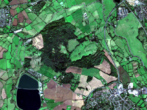
The cloud-free Sentinel-2A data over Wytham Woods on the 21/10/2021. Contains Copernicus Sentinel data 2021.
The measurement area was 180 m x 180 m, in accordance with a 3 x 3 pixel estimate of Sentinel-2’s coarsest resolution bands (60 m), and was completely forested. Fortunately, the time of the overpass was completely cloud-free, making it perfect for surface reflectance data acquisition conditions for both the UAV-mounted imager and the satellite.
